Wednesday, August 29, 2024
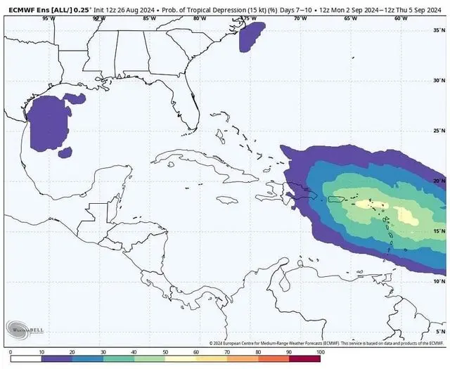
Over the Labor Day weekend or early next week, the chances of tropical waves hitting the Caribbean are predicted. The most prone area is still under watch with how big the wave might turn into.
It is predicted that a northward curve will continue to the west more. Generally, a tropical wave which evolves quickly is more likely to turn northwestward sooner and possibly track near the northern islands of the Caribbean. There are also more chances to get into the western part of the Caribbean than to turn up east of Florida. The area from Puerto Rico to Hispaniola may be affected by similar conditions, depending on intensity and organization.
On August 27, for the first time in a week, the NHC added an area of interest to the tracking map. As of now, the odds looked into are quite low at 20%. However, the NHC also predicted that the conditions might become favourable for low pressure to develop toward the end of the week. In case a low development is noticed, a movement near or into the Caribbean will begin and continue to the west into next week at 10 to 15 mph.
Also, there are probable chances that from the Yucatán Channel down to northern Honduras, scattered showers and a few thunderstorms along its path might follow along. In the eastern and central Caribbean, moderate to locally strong winds are creating waves between 3 and 5 feet.
Some primary factors meteorologists are closely looking into while forecasting tropical activity are moisture in the air, wind shear, and waves of low pressure that move westward across the Atlantic from Africa.
The influential aspects are the vast areas of dry air and high wind shear replaced with moisture and low wind shear. There are bound to be multiple tropical development risks that will unfold moving forward through September. Especially when the breezes are strong from one direction or changing directions, they can deter tropical development. Low wind shear will create favourable conditions for tropical systems to develop.
“The wave of rising air associated with the Madden-Julian Oscillation should reach the Atlantic basin during week one or two of September. We could then see a surge of tropical activity in the Atlantic,” said AccuWeather Lead Long-Range Meteorologist Paul Pastelok.
With Hurricane season officially running from June 1 through Nov. 30, many more waves could surge again over the tropical Atlantic. The features are being monitored regularly.


